Padre Island National Seashore is one of the longest barrier islands. After finding out this area is 60 miles to the Mansfield Channel I want to see if it’s possible to make it in and out in one day. Much of the beach is drivable however the automobile traffic breaks up the sand and creates balance issues for riding on two wheels.
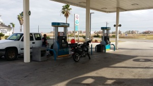
The last fuel stop. I did make it on one tank without using the extra fuel I carried. I would later find that the round trip logged in 152 miles to get back to the fuel stop.
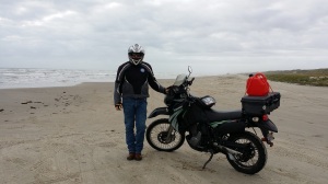
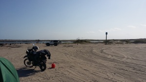
Thanks to Geni from Houston for snapping this pic. I call this “Point A”. The skies are cloudy and a slight chance of rain is forcast. Due to the shifting sand the helmet and armor will stay on all day.
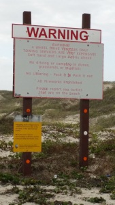
Warnings and Rules
The first 5 miles were easy enough. I kept my speed to near 20MPH. A few times the sand caused the front wheel to wabble however it is easy to spot the loose sand and reduce speed.
There are nautical debris scattered along the way. I choose not to post pics because it might make your ride less interesting.
However; this is the wreckage of the Nicaragua, ran ashore in a storm in the early 1900s. The firebox is visable and the locals say it’s possible to see more at low tide.
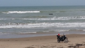
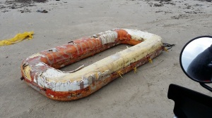
Debris…
I have made it to the Mansfield Channel. The milepost reads “60”. Time from Point A is 3 hours 15 minutes with a few short breaks.
My wife Lisa has packed lunch and i’m famished.
The channel ahead is 50 feet deep and there is now way across. The wreckage of a Spanish ship was found during the trenching of the canal.
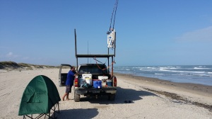
On the opposite side I see fishermen that have come from South Padre Island. Most of the ride in there were only a few fishermen scattered along the beach and here at the end I see there is a couple in a jeep having a picnic and one fisherman.
Ricky has been here for several days camping and shark fishing. He has pics of sharks he caught up to 6 feet long.
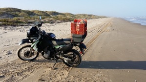
After a bit of sightseeing it is now 3:30pm. The wind has calmed somewhat and the tide is low. The low tide has exposed a hard packed surface than enables me to ride faster and with much less difficulty. Average speed now is near 35mph. This frees up some time to scavenge. There are rules against removing items but im taking my chances with a few floats I want to use for decoration. The basket makes it possible to carry more. There is alot of debris, mostly plastic bottles and rope. But I want to return some day just to scavenge thru the dunes.
By the way, the mosquitos are thick here. *Bring repellant*
With the sun on the horizon and 30 more miles to ride I decide to ‘set sail’. Around the 20 mile marker I notice a trophy buck.

By the time I exit the park it is dark. The guardshack is closed. There were only a handful of people scattered along the 60 mile return. As I pass the fuel stop the odometer roles to 152 miles.
Thanks for reading. If you know of a ride in this area that I might take please email, call, or comment.


